Hartsfield Jackson Atlanta International Airport (ATL)
Driving Directions / Travel by Car
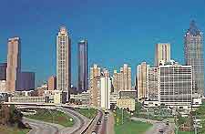
(Atlanta, Georgia - GA, USA)
Standing on the southwestern outskirts of Atlanta, Hartsfield Jackson Airport (ATL) can be reached in roughly 20 minutes. The eastern side of Atlanta Airport is skirted by Highway 75, while the western edge is bordered by Highway 85, close to Highway 285 (the Bob A. Holmes Freeway).
To the north of Atlanta Airport, the Airport Boulevard joins the North Inner Loop Road / Perry J Hudson Parkway, which becomes the South Inner Loop Road. On the northern side you will also find East Point and Hapeville, while Forest Park and Fort Gillem are located to the east, close to Clayton State University. Nearby Hartsfield Atlanta Airport, College Park lies to the northwest, near to the College Park Municipal Golf Course.
Other notable roads surrounding the Hartsfield Atlanta Airport complex include Virginia Avenue, Old Dixie Highway, Clark Howell Highway, Sullivan Road, Phoenix Boulevard, Godby Road, Riverdale Road and the Roosevelt Highway.
Directions to Hartsfield Atlanta Airport (ATL) from the north / downtown:
- Head south and join the Highway I-85 South
- Follow the sign posts for Hartsfield Airport and take exit 18A
Directions to Hartsfield Atlanta Airport (ATL) from the south:
- Head north and take Highway I-75 North
- Take the road sign posted I-285 West
- Follow the sign posts for Hartsfield Airport and take exit 3
Directions to Hartsfield Atlanta Airport (ATL) from the east:
- Head towards the Highway I-285 south
- Take the road sign posted I-85
- Follow the sign posts for Hartsfield Airport and take exit 18A
Directions to Hartsfield Atlanta Airport (ATL) from the west:
- Head towards the Highway I-285 south
- Take the road sign posted I-85
- Follow the sign posts for Hartsfield Airport and take exit 18A
Hartsfield Jackson Atlanta International Airport (ATL): Virtual Google Maps
